Fred Vogels Contact
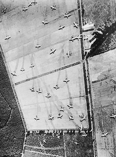
Reconnaissance aerial photo showing British Horsa and Hamilcar gliders on Landing Zone 'Z' near Wolfheze woods, west-north-west of Arnhem, Operation Market I, 17 Sep 1944
A new map section is now available at maps.fredvogels.com.
You can choose a location anywhere on the map and discover nearby records, names and events from the history database.
The search starts within a small radius, so the map remains useful for the visitor, not overloaded with thousands of records at once.
This message is shown only once.

