Fred Vogels Contact
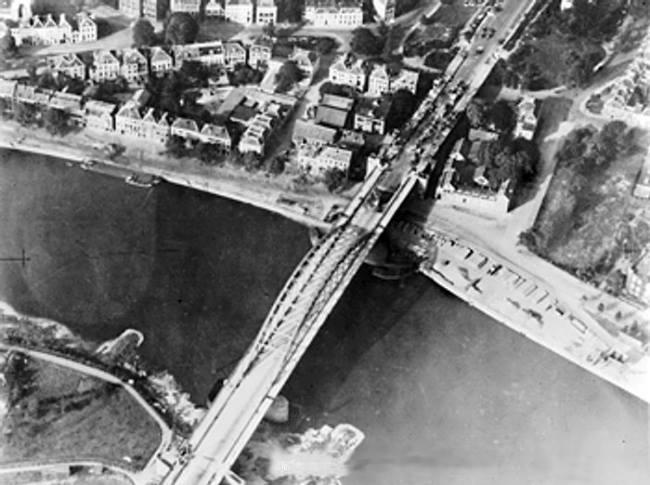
Aerial view of the bridge over the Nederrijn, near Arhnem, the Netherlands, circa 19 Sep 1944; note British troops and armored vehicles at north end of the bridge
A new map section is now available at maps.fredvogels.com.
You can choose a location anywhere on the map and discover nearby records, names and events from the history database.
The search starts within a small radius, so the map remains useful for the visitor, not overloaded with thousands of records at once.
This message is shown only once.

